This site uses cookies, as explained in our terms of use. If you consent, please close this message and continue to use this site.
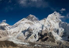
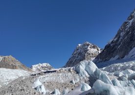
The Kangchenjunga Landscape (KL) spreads over an area of 25,085.8 sq.km that is home to 7.2 million people. Nepal covers 21% of total KL area and is home to 11% of the total landscape population. The International Centre for Integrated Mountain Development (ICIMOD) and Research Centre for Applied Science and Technology (RECAST), Tribhuvan University, Kirtipur, Nepal partnered to achieve conservation and development goals in the landscape. A letter of agreement was signed on 6 June 2016 by David Molden, Director General of ICIMOD and Ram Prasad Chaudhary, Executive Director of RECAST under the guidance of the Ministry of Forests and Soil Conservation (MoFSC).
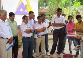
The basis of the implementation phase in Nepal was a result of long term collaboration between MoFSC, ICIMOD and RECAST. The partners worked rigorously to assess the feasibility of the landscape, prepared conservation and development strategy, and endorsed Regional Cooperation Framework to achieve the mutual objective of improving livelihoods and enhanced ecological integrity, economic development, and socio-cultural resilience to environmental changes in Kangchenjunga Landscape-Nepal and in the region.
Three pilot sites in three districts — Panchthar, Ilam and Jhapa — were selected to start the work in the landscape. In Panchthar District, the focus is on conservation and development of Argeli for livelihood diversification and ecosystem conservation. Similarly, in Ilam district, the emphasis is on conserving the Mai Pokhari, the only Ramsar site in the KL, and scaling up its contribution to eco-tourism and related livelihood opportunities. Similarly, the team will work on Human Wildlife Management in the Bahundangi area of Jhapa district. In addition to these, the greater focus is also provided for corridor management where transboundary cooperation will be enhanced and mutual strategies will be adopted to achieve common transboundary goals.
The KLCDI team in Nepal are looking forward to an enhanced well-being for the target population in the landscape, improved ecosystem, and strengthened regional cooperation for transboundary landscape management in Bhutan, India and Nepal.
Share
Stay up to date on what’s happening around the HKH with our most recent publications and find out how you can help by subscribing to our mailing list.
Sign UpRelated Content
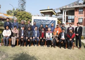
The UIBN–AC Meeting was primarily held to recap previous meetings, discuss the progress made by the country chapter’s Technical Working ...
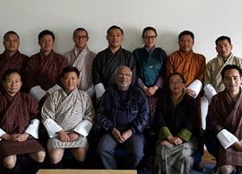
A three-day training for Bhutanese partners on vulnerability assessment was conducted ...

Developing green enterprise that can align social and economic goals with cultural and environmental ones is key ...
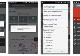
ICIMOD and Kathmandu University, Nepal, launched ‘Disaster Reporting’, an android application that enables users to report disaster events along with ...